

Estimated reading time: 5 minutes
After a brief January thaw, we are back to real Pennsylvania January weather as a cold front helps to return snow showers and snow squalls across the state. This blast of colder air will also help to bring additional light snowfall accumulations to northwestern Pennsylvania and the Laurel Highlands. Let’s jump into the details!
CLICK TO JUMP TO THE FOLLOWING:
SNOW SQUALL SAFETY:
What is a snow squall? A snow squall is an intense, short-lived heavy burst of snowfall accompanied by gusty winds. Think of them as thunderstorms without the rain. Some intense snow squalls may have lightning! Squalls this afternoon may produce a quick half inch to an inch of snowfall in as little as 30 minutes.
Why should you care? Snow squalls are VERY dangerous when it comes to travel, especially on interstates. Snow squalls have had a history of producing multi-car pileups on interstates in past years across the state.
Within a snow squall, be on alert for RAPIDLY deteriorating conditions in as little as MINUTES. Even if road conditions are wet prior to the squall, a flash freeze may occur and make for very slick conditions. Snow squalls may lead to chain-reaction accidents and very hazardous travel.
What should you do if you are caught in a snow squall? Get off the highway. Consider an alternate route or delaying your travel. Reduce your speed and turn on your headlights. If you are caught in a multi-vehicle pileup, DO NOT stand outside of your vehicle or on the roadway.
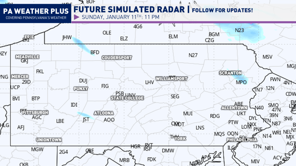
FUTURE RADAR TIMING:
I have a page on the website dedicated to giving you a more accurate timing forecast for your given location. Check it out here! Your Local Weather
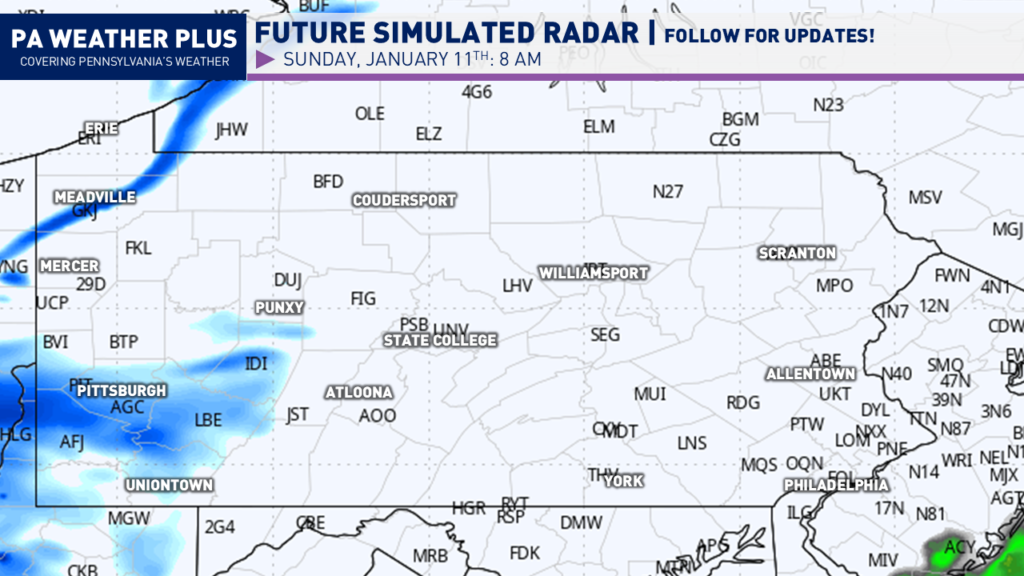
Snow showers and snow squalls will begin to break out across western Pennsylvania shortly after sunrise on Sunday. Some of these snow squalls could be intense, especially near Erie and Pittsburgh.
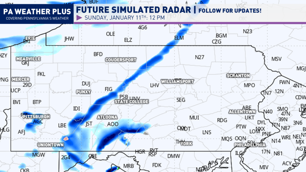
Heading toward the lunch hour, these snow squalls will move into central Pennsylvania. Some of these squalls can be intense as well, especially near State College and Altoona.
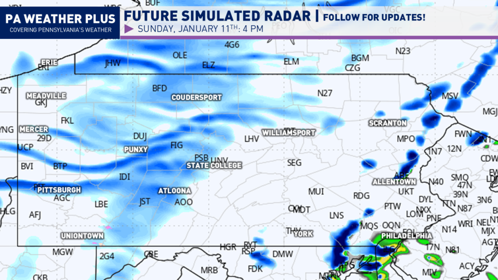
By the mid-to-late afternoon, snow squalls will move into eastern Pennsylvania, impacting Allentown, Scranton, and Philadelphia. A secondary round of snow showers and squalls will fire across western Pennsylvania. Be on the lookout for reduced visibility.
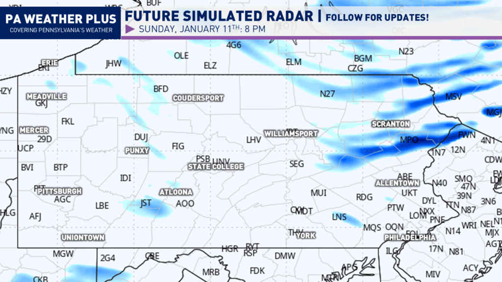
By the early evening hours, we will begin to see much of the activity wane. Across northeastern Pennsylvania, we will see lingering snow squall activity from the second round. These squalls could be, at times, heavy and produce coatings of snow on roadways.
Toward midnight, much of the snow will begin to wrap up. There still could be areas of lake-effect snowfall that are not being picked up on model guidance. All of the snow should be fully wrapped up by 4 AM on Monday.
I have a page on the website dedicated to giving you a more accurate timing forecast for your given location. Check it out here! Your Local Weather
SNOWFALL FORECAST SUNDAY MORNING THROUGH MONDAY MORNING ACROSS PENNSYLVANIA:
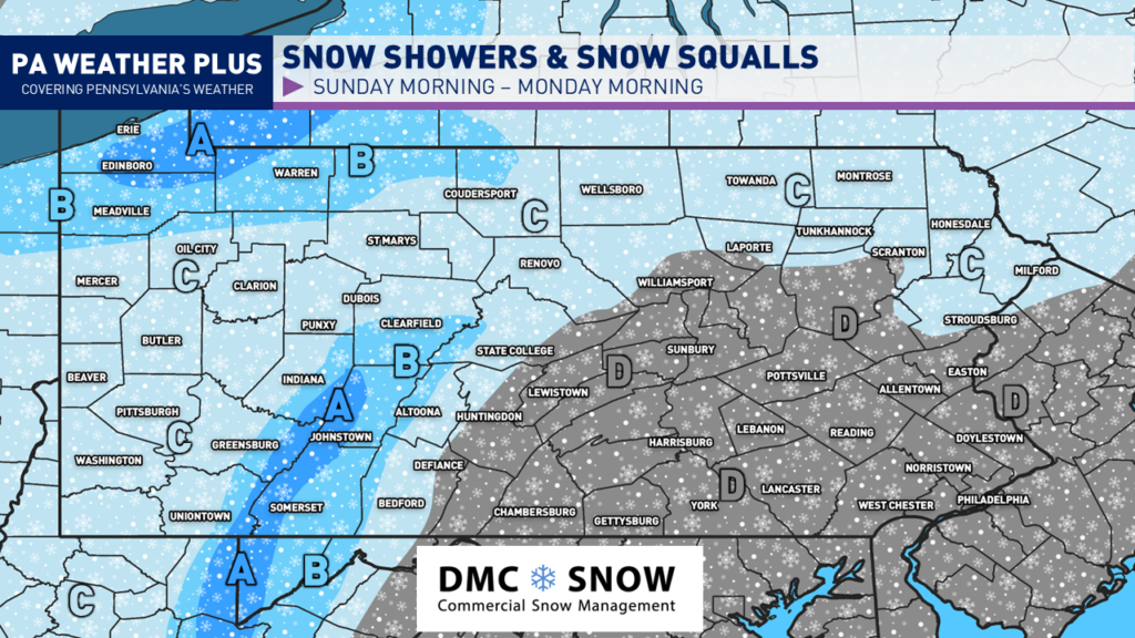
AREA A: 2 – 4 inches of snow expected, locally up to 5 inches across Erie County. Roadways may become snow-covered during intense snow showers and snow squalls.
AREA B: 1 to 2 inches of snow expected. Roadways may become briefly snow-covered during intense snow showers and snow squalls.
AREA C: Most areas will see a coating to 0.5, with upwards of 1 inch possible in the heaviest snow showers and snow squalls. Be on the lookout for brief whiteout conditions in snow squalls.
AREA D: Most areas will see a quick coating within a snow shower or squall. Localized up to a half inch, not ruled out (if a squall is much heavier). Be on the lookout for brief whiteout conditions in snow squalls.
Thank you for reading! If you are planning to travel tomorrow, be on the lookout for rapidly changing weather conditions as snow squalls may make for brief hazardous travel conditions. The active pattern of winter is returning with increased accumulating snow risks as we head into the latter half of the week and into next week. Stay tuned for updates!
-Meteorologist Denys K.
