Get ready for a relatively nicer weekend with a few showers and storms around. The precipitation coverage remains to be more on isolated side compared to the last few weeks, so more areas remain dry than wet. Although, there is one day this weekend that sticks out for the greatest chance for precipitation. Here’s what you can expect day-by-day in Pennsylvania this weekend:
FRIDAY, JULY 18TH:

Friday looks to be a great day for much of the state. After the cold front passes through Thursday evening, much drier and calmer air will be ushered in. The majority of the state will see mostly sunny to partly cloudy skies. However, lingering moisture with the front may allow for a pop-up shower or storm, primarily across southwestern PA.
Larger towns/cities at greatest risk: Pittsburgh, Washington, Johnstown, Somerset, Gettysburg, York
AREA A – Isolated (10-25%) chance of showers and thunderstorms, primarily between 2 – 6 PM. The main concern will be a heavier downpour and possibly gusty winds. Severe weather is not expected, although any heavier storm may cause a local concern for flooding.
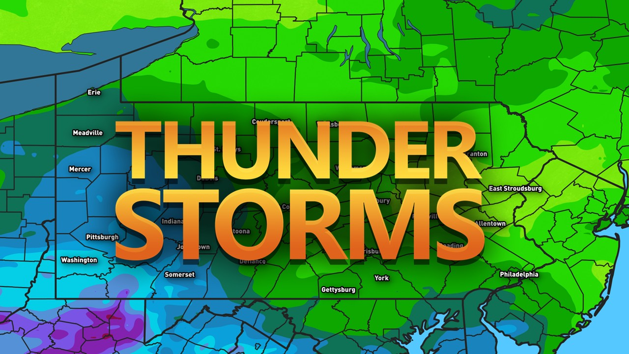
SATURDAY, JULY 19TH:

Saturday appears to be a bit unsettled, although it is still uncertain on where and when we will see the best chance of precipitation, which will be dependent on bouts of weaker disturbances that will be moving through. Once areas of higher confidence are figured out, an update in precipitation chances to scattered may be warranted. Otherwise, expect a mix of sun and clouds with temperatures holding into the upper-70s to low-80s for most locations.
Larger towns/cities at greatest risk: Pittsburgh, Erie, State College, Scranton, Allentown, Harrisburg, Philadelphia
AREA A – Isolated (15-30%) chance of showers and thunderstorms. Exact timing and coverage will be determined in the upcoming day or so. The main concern will be a heavier downpour and possibly gusty winds. Severe weather is not expected, although any heavier storm may cause a local concern for flooding.
SUNDAY, JULY 20TH:

By Sunday, we will have another cold front work its way into the state, bringing relief in terms of temperatures and humidity across the northwestern tier. For others, expect isolated showers and storms as the cold front slowly makes it way through. Keep in mind, an upgrade to scattered precipitation coverage may be necessary, depending on how fast the cold front moves through. A slower-timed front will increase precipitation chances (general area A) and vice versa. Stay tuned for updates!
AREA A – Isolated (15-30%) chance of showers and thunderstorms. Best timing will be 1.2 – 8 PM. The main concern will be a heavier downpour and possibly gusty winds. Severe weather is not expected, although any heavier storm may cause a local concern for flooding.
TOTAL PRECIPITATION:

Here is a general sense of how much precipitation is expected through Sunday. Keep in mind, some locations may see more or less precipitation, depending on where the heaviest showers and storms develop. This precipitation forecast is bound to change and may not reflect the heaviest thunderstorms. Any slower-moving heavier storm may be able to produce flash flooding this weekend, so please keep that in mind.
That is all for this weekend’s outlook. I hope to continue to expand these to bring more details to your weekend weather. If you have any questions, please feel free to reach out!
FIND YOUR LOCATION FORECAST HERE: https://paweatherplus.com/your-local-weather/
– Meteorologist Denys K