It really is a never-ending winter of blasts of cold air and accumulating snowfall events. While we had a short break since the last winter storm in late January, we have another accumulating snow event on our doorstep, which will just add onto the glaciating snowpack across the state! Read below for all of the details.
If you are here for the snowfall map only, press “FIRST CALL SNOWFALL AMOUNTS” to jump to the bottom of the article!
CLICK TO JUMP TO THE FOLLOWING:
INTENSE ARCTIC BLAST:
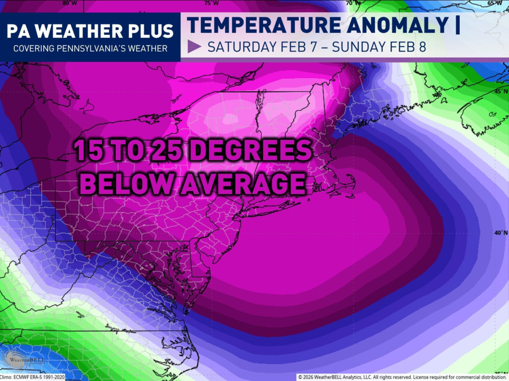
A strong blast of arctic air will arrive on Saturday and Sunday, bringing very cold temperatures and gusty winds. This looks to be a bit worse than this past weekend due to the potential for higher wind gusts, allowing for longer and prolonged colder wind chill values. This may allow for high temperatures to remain lower than the recent prolonged cold blast. If you have any outdoor plans this weekend, be prepared for this next blast! This will be coming in behind the clipper system. I have additional details on the magnitude of the cold toward the end of the blog post!
FUTURE RADAR TIMING:
While it is still too early to get an hour-by-hour future radar simulation of the incoming snow event, here are the approximate start times of when the snow may begin across the state of Pennsylvania on Friday. Western PA will see the snowfall first, and this area of snow will slide eastward. Keep in mind, as this system makes its way over the Appalachian Mountains, it will be battling larger areas of dry air, so start times east of the pink zone may be fairly inconsistent.
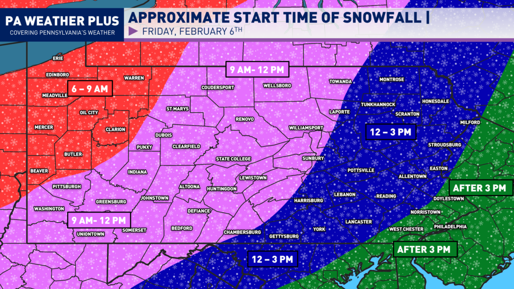
The end time of the snowfall event is still uncertain. An additional disturbance may now move into the region on Saturday morning and afternoon, which may prolong the snowfall event across much of eastern Pennsylvania. As of right now, the snow is expected to end sometime Friday night into Saturday morning across western & central Pennsylvania and sometime Saturday early afternoon across eastern Pennsylvania. Here is a GIF showing a simulation of the recent run of the NAM model, which has a good representation of what may occur.
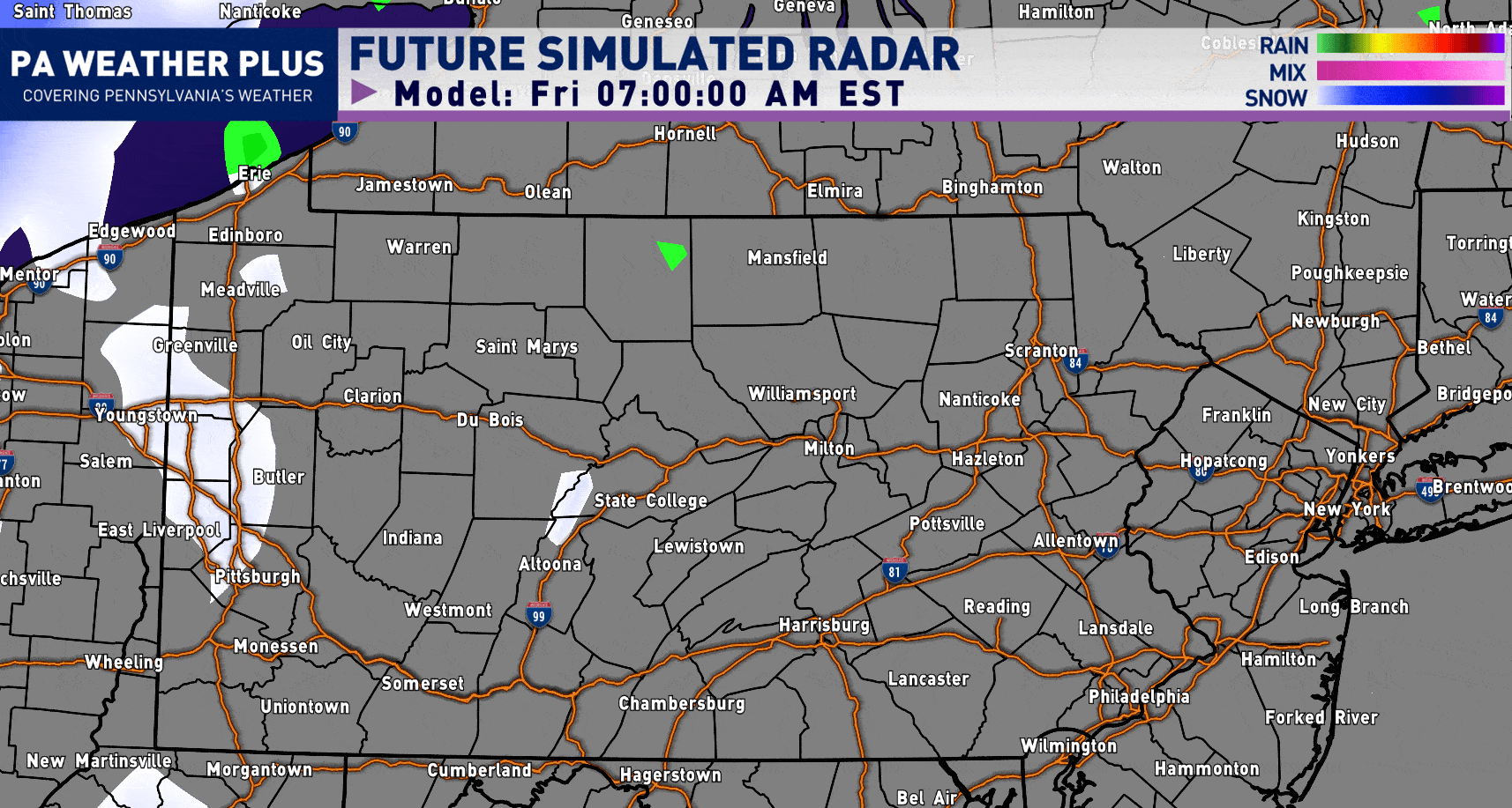
Ignore the “rain” showing up ahead of the snow shield- that is an internal error on the software (it is snow “falling” but not reaching the ground due to initial dry air).
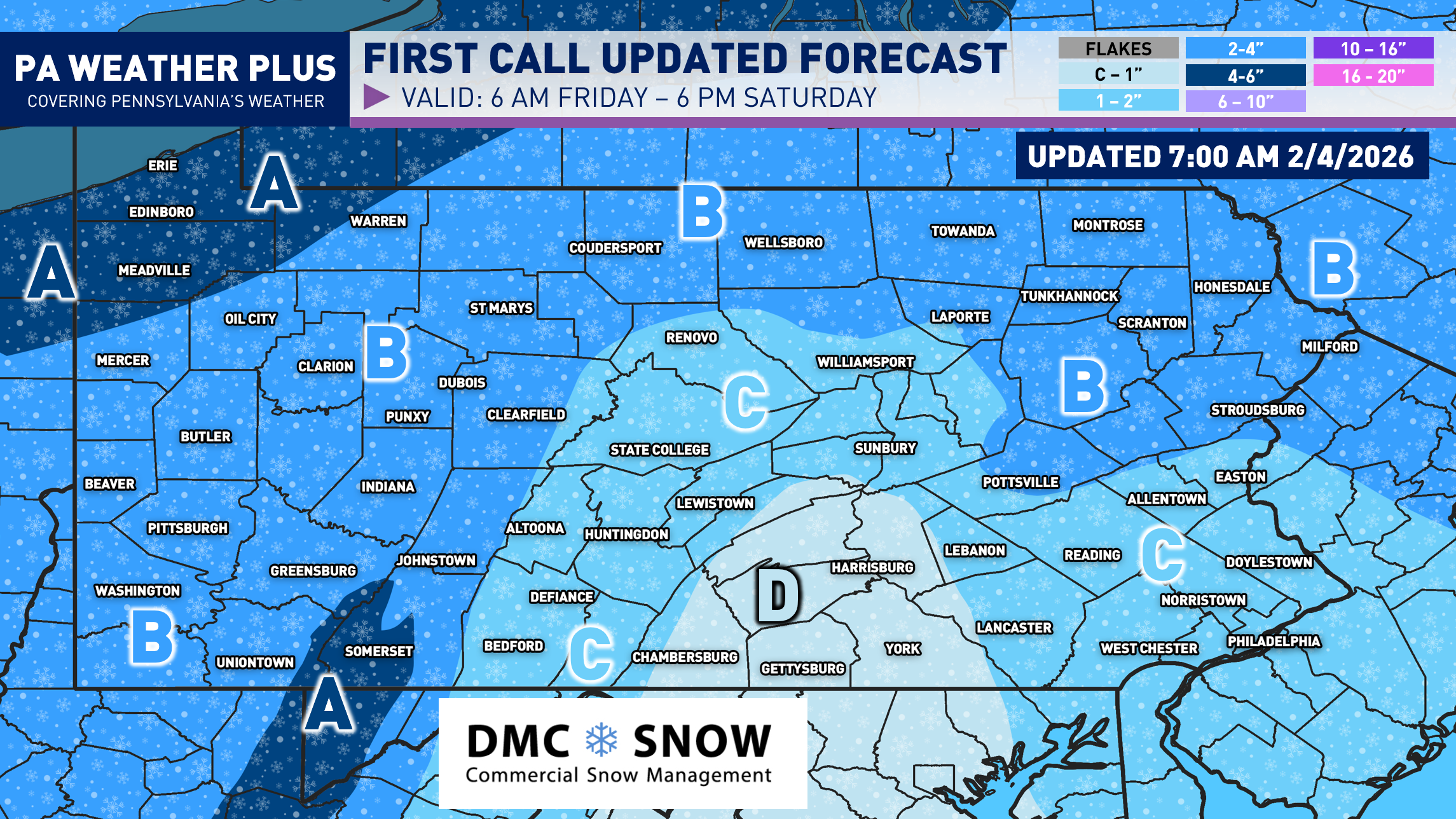
FIRST CALL SNOWFALL AMOUNTS:

AREA A: 4 to 6 inches of snow is expected. Roadways will become snow-covered during intense snow showers and snow squalls. Some school/business closures are possible across western Pennsylvania, where the snow is expected to begin earlier in the morning.
AREA B: 2 to 4 inches of snow is expected. Roadways will become snow-covered during intense snow showers and snow squalls. Some school/business closures are possible across western Pennsylvania, where the snow is expected to begin earlier in the morning.
AREA C: 1 to 2 inches of snow is expected. Roadways may become snow-covered during intense snow showers and snow squalls, especially Friday night into Saturday morning across this area.
AREA D: A coating to 1 inch of snow is expected. Areas of drier air will limit the potential for steadier snowfall. Any snow squall or heavier snow shower may cover roadways.
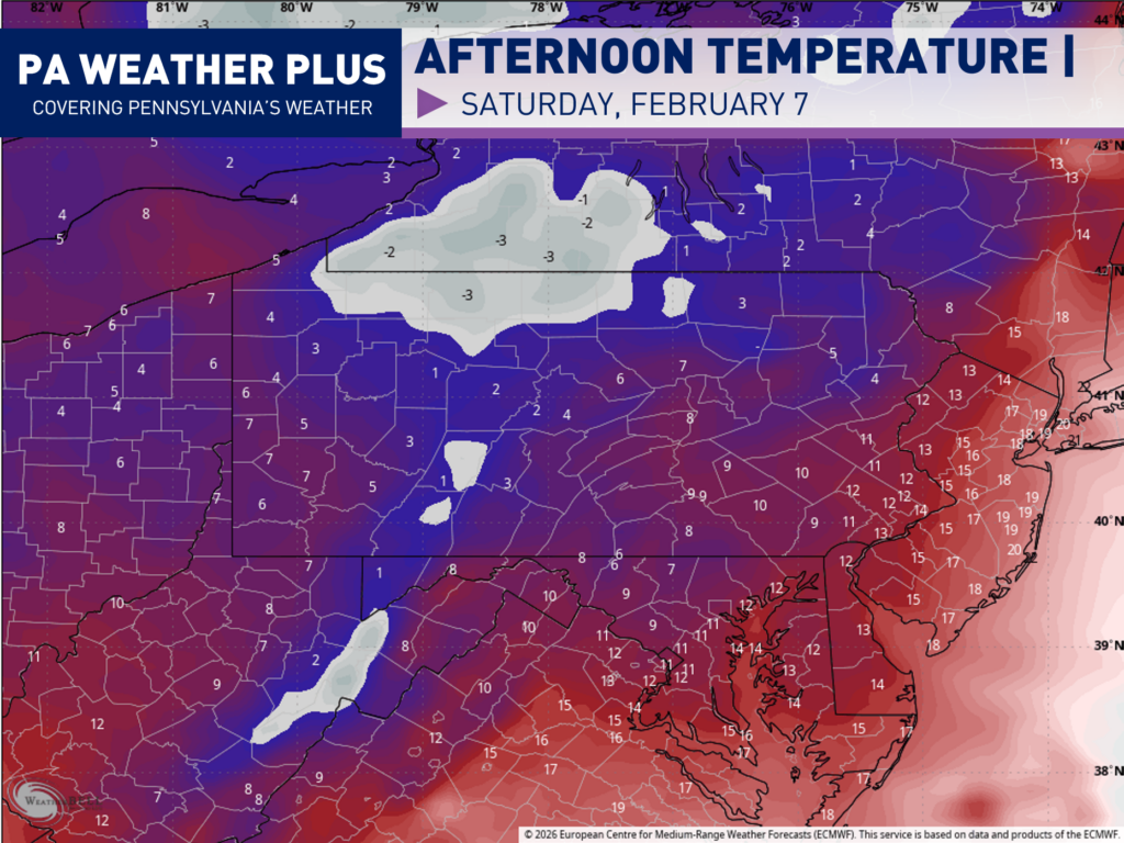
EARLY PROJECTED WEEKEND HIGH TEMPERATURES:
Behind the clipper system, some of the coldest air of the season yet will filter in across the state. Here is an early look at the projected “high” temperatures for Saturday afternoon. Many areas will struggle to climb out of the single digits to the lower tens. Wind chill values will be in the -5 to -25 range throughout the day.
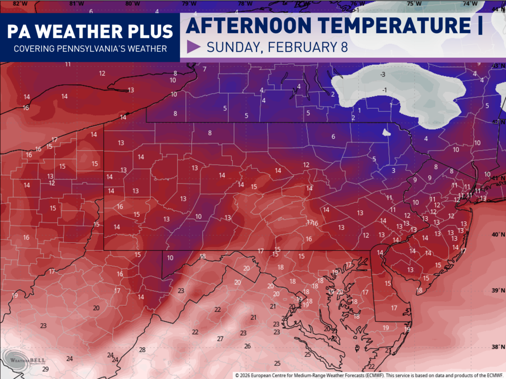
Sunday will be a tad “warmer”, although still cold. High temperatures will range from the upper single digits to the lower teens across the state. Wind chill values will range from +5 to -10 across the state throughout the afternoon on Sunday.
These are still developing details on the incoming snow event and the frigid airmass. Make sure to stay tuned to updates by following PA Weather Plus on Facebook, Instagram, and/or X. I appreciate all of your support and thank you for reading through all of the details!
-Denys