Estimated reading time: 6 minutes
Over the last few days, the pattern has “quieted down” with just slightly below average temperatures and lots of clouds, and little sunshine. However, as we head into the new week, we will see multiple blasts of colder winter-like air and an opportunity for light accumulating snow. Here is what to expect over the next few days!
JUMP TO THE FOLLOWING:
MONDAY NIGHT COLD BLAST:
A cold front moved through Sunday night, which will usher in much colder winter conditions to start the new workweek. High temperatures on Monday afternoon will be as much as 15 to 20 degrees below average, which is reflective of temperatures in the upper-teens to mid-20s for many locations.
The biggest chill will come Monday night as higher pressure moves in, clearing our skies and plummeting the temperatures. To maximize cooling on a winter night, you need; a strong high-pressure system overhead, calm winds, and preferably a snow pack. This leads to perfect radiational cooling, and surface temperatures are able to cool rapidly.
This will ‘perfect cooling’ effect will occur Monday night into Tuesday morning, which is similar to what occurred this past Friday morning!

AREA A: Low temperatures between -5 to +2°F. Wind chill values -5 to -12 °F.
AREA B: Low temperatures 2 to 9°F. Wind chill values -5 to +2°F.
AREA C: Low temperatures 9 to 15°F. Wind chill values 5 to 10°F.
AREA D: Low temperatures 15 to 19°F (Philadelphia: 20-22°F). Wind chill values 10 to 15°F.
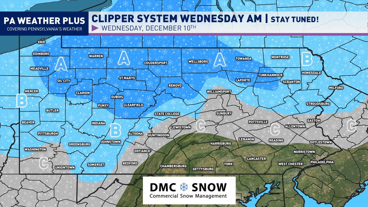
WEDNESDAY CLIPPER SYSTEM:
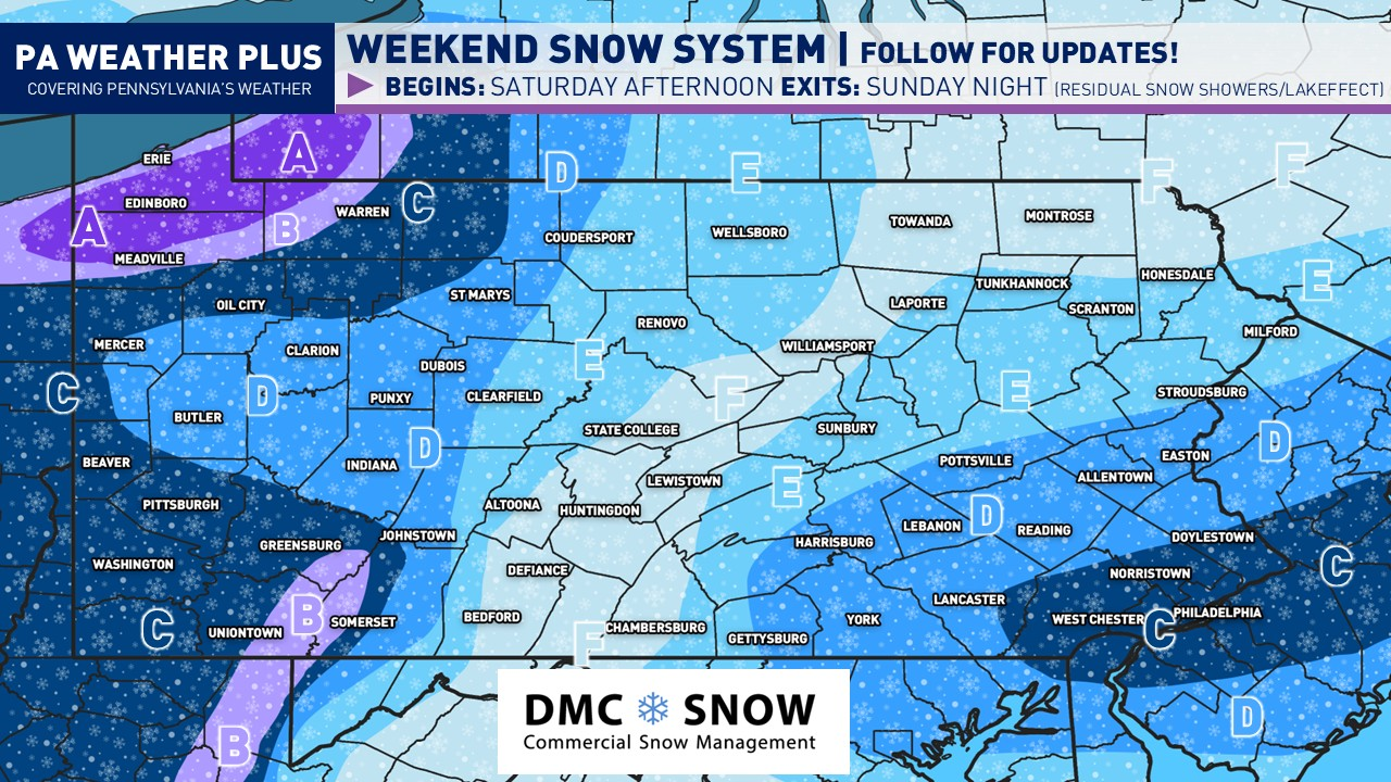
Another wave of precipitation will come in the form of a clipper (fast-moving system from the northwest). This will allow for another opportunity for snow, especially across the northern half of the state, where the greatest amount of moisture will be.
Areas farther south and east across the state will see flurries mixed with rain showers. Below is a modeled image of the potential precipitation types by Wednesday morning, indicating potential winter weather conditions.


AREA A: Looking at up to 2 to 4 inches of snow late Tuesday night through Wednesday morning. Expect snow-covered roadways, especially early Wednesday AM. Additional snowfall is possible on Wednesday night with lake-effect snowfall.
AREA B: Looking at up to 1 to 2 inches of snow late Tuesday night through Wednesday morning. Expect a few snow-covered roadways, especially early Wednesday AM. Additional snowfall is possible on Wednesday night with lake-effect snowfall, especially in western Pennsylvania.
AREA C: Minimal accumulations generally expected late Tuesday night through Wednesday morning with snowflakes mixing with rain. Areas closer to Area B may see minor accumulations with upwards of an inch of snow in the higher hills/mountains. Expect minimal impacts on Wednesday morning.
SECOND BLAST OF COLDER AIR:
Behind the clipper system Wednesday morning, temperatures Wednesday afternoon will warm up into the 30s and 40s, allowing for improving conditions after the snow potential in the morning. As we head into Wednesday night, another stronger cold front will move through, bringing a return of much colder, winter-like conditions. Thursday afternoon, high temperatures will struggle to climb out of the 20s for many locations, with some areas stuck around the 20-degree mark (mostly N-C PA & Laurel Highlands).

Fortunately, Wednesday and Thursday nights will not be as cold as compared to Monday night due to increased cloud cover and gustier conditions. Temperatures will still drop into the teens and 20s for most of the state both of those nights.
THIRD BLAST OF COLDER AIR (most potent):
The most potent blast of colder air will appear to come through Friday night and into Saturday morning/afternoon. With this blast, we will see more legitimate colder air filter in on the backside of this third cold front. Wind chill values Saturday morning and afternoon appear early to be in the negatives for much of western and central Pennsylvania, with eastern Pennsylvania in the positive single digits and teens. This front will bring with it periods of snow showers and snow squalls, typical of harsh winter weather. Actual air temperatures Saturday afternoon will likely only be in the teens to low-20s.

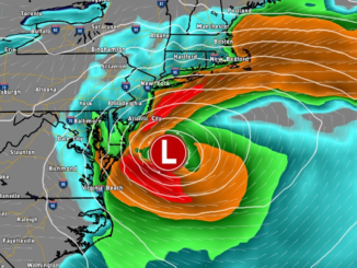
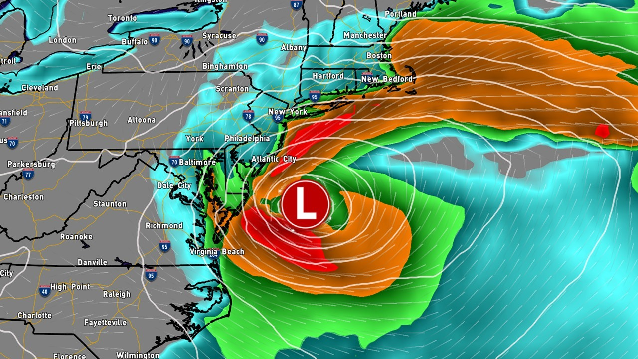
WATCHING FOR A COASTAL STORM?
While many are starting to hype up a potential winter storm next weekend, the true reality is still unknown. On the back end of our Saturday arctic blast, we will need to watch a piece of energy that will come out of the Midwest. As this moves into the Mid-Atlantic, we will need to watch for a possible developing low-pressure system. Now, where this develops and tracks is still highly uncertain. A track closer to the shoreline would bring greater impacts to the region on Sunday. A flatter out-to-sea track would bring minimal snow shower impacts.
There is still a lot of uncertainty with this one, but the pattern does favor a flatter scenario (out to sea). Despite this, we are still 6 – 7 days out from this occurring, so it will be just something to keep an eye on throughout the week!

Thank you for taking your time to read this blog post! We have quite the week ahead of us with multiple chances for much colder air and some accumulating snowfall. As always, ignore any hype you see online regarding future winter storms. The pattern overall favors flatter, faster storm systems, but as a meteorologist, it is still crucial to watch every storm system one-by-one as changes will and do occur in a week’s timespan. Stay tuned for updates!
-Meteorologist Denys K