Ever since the event last Tuesday, most of the snow has tracked south of Pennsylvania and into the southern portions of the Mid-Atlantic. This next clipper will finally track north enough to bring us light snowfall accumulations for Wednesday morning and into the early afternoon. The best of the accumulating snow will mostly remain in the higher elevations due to marginally cool temperatures, but many will see at least some ‘festive’ flakes.
READ MORE ON THE WEEKLY WEATHER EVENTS: https://paweatherplus.com/blasts-of-colder-air-and-some-pennsylvania-snow/
LITTLE BIT OF METEOROLOGY:
We’ve been stuck in a northwest flow pattern over the last 10-ish days, which has allowed for multiple systems to pass through (either at times north or south of the state), bringing weak systems. This one on Wednesday will track right in the middle, which is why we will see more impacts. This clipper pattern is expected to continue through the weekend. Behind each clipper, a new blast of colder air follows.

FUTURE RADAR:
Snow will begin to move into western Pennsylvania by 4 – 6 AM. This quick thump of snow may be moderate to heavy at times. Areas across southwestern Pennsylvania will begin as a rain/snow mix.

By the time we get to the 7 – 10 AM time range, snow will overspread much of the northern half of the state. A wintry mix is expected for portions of eastern Pennsylvania, and rain/snow showers will continue for southwestern Pennsylvania.

Heading into the later parts of the morning, snow will continue to fall across much of the state outside of south-central and southeastern Pennsylvania. The best snowfall will be falling across northwestern Pennsylvania, where it will be the coldest, and also across the Laurel Highlands.

By the time we head into the mid-afternoon, we will begin to see the bulk of the system move out, and additional lake effect snowfall will begin to develop across portions of western Pennsylvania. Lingering rain / snow showers will continue across eastern Pennsylvania as the system begins to move out.

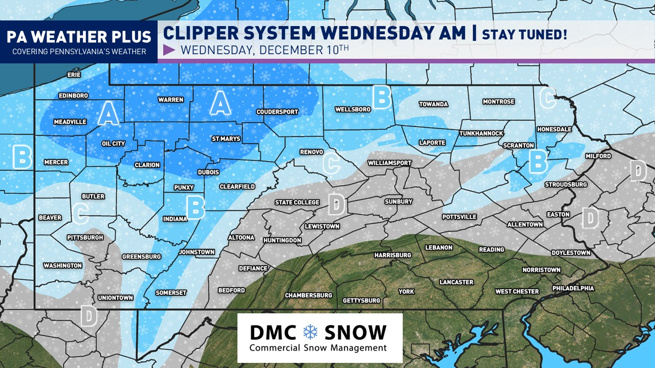
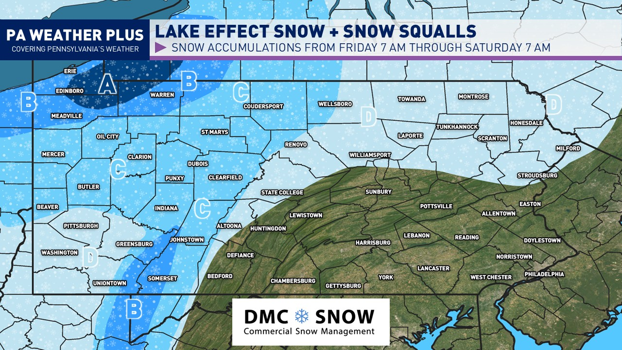
FIRST CALL SNOWFALL FORECAST:

NOTE: These snowfall amounts do not include the additional lake effect on Wednesday night.
AREA A: Expect 2 to 4 inches of snow through late Wednesday afternoon. Expect snow-covered roadways, especially early Wednesday AM. School delays and cancellations are possible. Additional snowfall is possible on Wednesday night with lake-effect snowfall.
AREA B: Expect 1 to 2 inches of snow through late Wednesday afternoon. Expect a few roadways to be snow-covered, especially early Wednesday AM. A few school and business delays are expected.
AREA C: Expect less than an inch of snow through late Wednesday afternoon. A few slick spots are possible, especially Wednesday AM, and in the higher elevations of this zone.
AREA D: General flakes expected with minor dustings possible on elevated surfaces. Issues are generally not expected, although watch for any high-elevation roadway to briefly become dusted, especially before sunrise on Wednesday.
That is it for this quick forecast regarding the clipper system. Another clipper system will move into the western half of the state late Friday evening (likely to be light), and another stronger system may move in Saturday night into Sunday morning. Stay tuned for updates!

-Meteorologist Denys K