Rain will change to periods of accumulating snow across the state Wednesday night into Thursday morning. While it will not be a large winter storm (as many others have hyped from this past weekend), impacts are expected with rapidly falling temperatures and accumulating snow. Read below for all of the details!
3:00 PM 1/14 UPDATED SNOWFALL GRAPHIC: https://www.facebook.com/share/p/183TPZf1vD/
CLICK TO JUMP TO THE FOLLOWING:
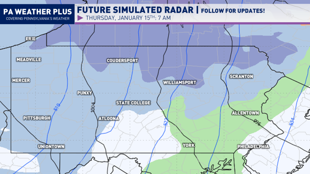
FUTURE RADAR TIMING:
Periods of rain will begin to move into the state mid-to-late afternoon. With temperatures initially above freezing, any wet snowflakes that do mix in should not cause issues. Expect changing conditions later into the evening and overnight hours.
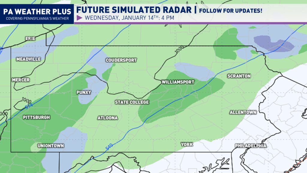
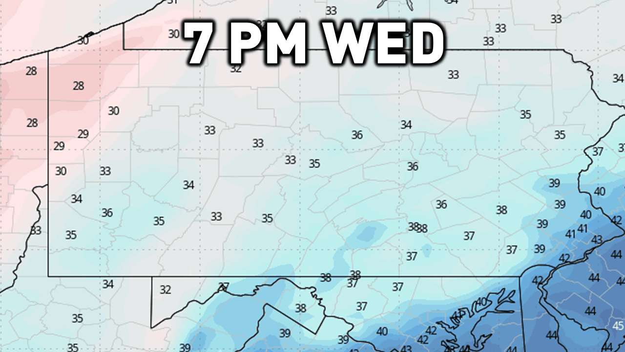
Toward midnight, rain will changeover to snow as our cold front moves through, ushering in much colder air. Steady periods of snow will begin across western and northern Pennsylvania.
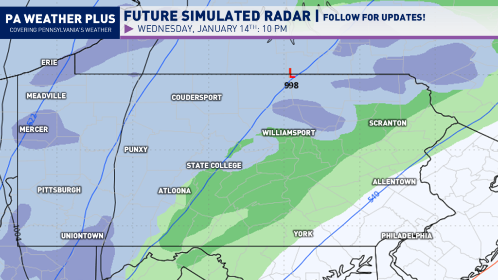
After midnight appears to be the bulk of the storm. This is when we will see steadier periods of snow across much of western and northern Pennsylvania. With falling temperatures, expect the potential for snow-covered roadways and interstates.
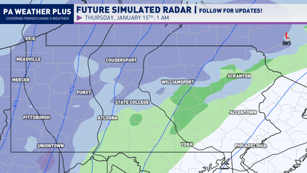
By the Thursday morning commute, the system will begin to wrap up with the steadiest snow expected across northern Pennsylvania. Residual snow showers will be expected elsewhere. Eastern Pennsylvania will be the last to changeover, with rain showers mixed with wet flakes on Thursday morning.
By Thursday afternoon, we will see additional snow showers and snow squalls. The steadiest snowfall will be closer to the lakeshore. With expected snow squalls, be on alert for rapidly changing weather conditions Thursday late-morning and afternoon.

I have a page on the website dedicated to giving you a more accurate timing forecast for your given location. Check it out here! Your Local Weather
RAPIDLY FALLING TEMPERATURES:
Temperatures will be rapidly falling on Wednesday evening and into Thursday morning. This rapid temperature drop will allow for slickening of roadways and interstates, especially with falling snow across much of western and northern Pennsylvania. Temperatures will fall from the 30s to the teens and low-20s, so any wet or slushy surfaces will freeze over. If you are planning to travel, take it easy!
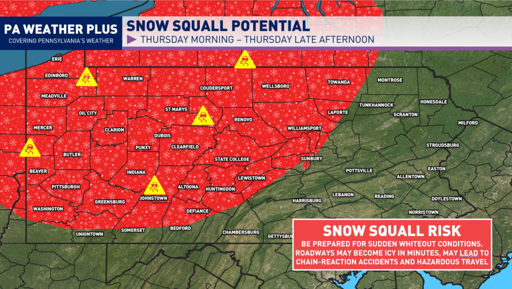
SNOW SQUALL RISK THURSDAY:
A snow squall is an intense, short-lived heavy burst of snowfall accompanied by gusty winds. Think of them as thunderstorms without the rain. Some intense snow squalls may have lightning! Squalls this afternoon may produce a quick half inch to an inch of snowfall in as little as 30 minutes.
Snow squalls will be possible across the western and central thirds of the state Thursday morning through the afternoon hours. Be on the lookout for the potential as snow squalls have caused multi-vehicle collisions over the last few weeks, particularly on I-80.
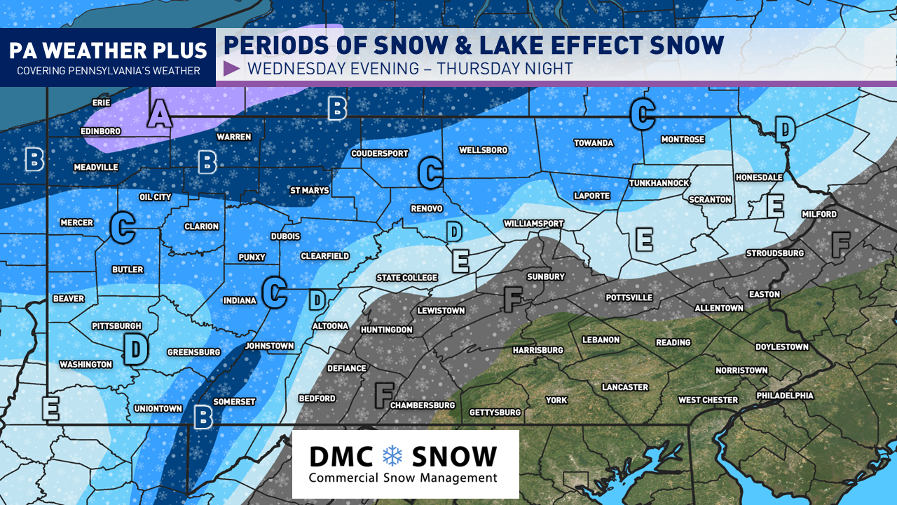
FIRST CALL SNOWFALL FORECAST WEDNESDAY NIGHT THROUGH THURSDAY NIGHT ACROSS PENNSYLVANIA:

ALL ZONES: Be on the lookout for brief whiteout conditions in snow squalls Thursday morning/afternoon. Roadways may become briefly snow-covered during intense snow showers and snow squalls.
STEADIEST SNOW ZONES
AREA A: 6 to 10 inches of snow expected. Roadways and interstates will become snow-covered late Wednesday night and into Thursday morning. Expect business delays and slower travel on Thursday AM.
AREA B: 4 to 6 inches of snow expected. Roadways and interstates will become snow-covered late Wednesday night and into Thursday morning. Expect business delays and slower travel on Thursday AM.
AREA C: 2 – 4 inches of snow expected. Roadways will become snow-covered late Wednesday night and into Thursday morning. Expect business delays and slower travel on Thursday AM.
LIGHTER SNOW ZONES
AREA D: 1 to 2 inches of snow expected. Some roadways will become snow-covered late Wednesday night and into Thursday morning. Expect business delays and slower travel on Thursday AM.
AREA E: Coating to 1 inch of snow expected. Be on the lookout for some slick roadways on Thursday AM
AREA F: Most areas will see a quick coating within a snow shower or squall. Localized up to a half inch, not ruled out (if a squall is much heavier). Be on the lookout for brief whiteout conditions in snow squalls.
Thank you for reading! If you are planning to travel from Wednesday night into Thursday, be on the lookout for rapidly changing weather conditions. The Thursday morning commute is looking to be messy with snow-covered roadways. Additional snow squalls are expected Thursday afternoon to make for hazardous travel conditions. Stay tuned for updates! A final call forecast will be released on Wednesday morning.
-Meteorologist Denys K.